

Today we’re looking at the world of vintage maps. A few weeks ago, Horacio sat down with Laura Tan Eyck, a Gallery Director at NYC’s Argosy Bookstore. She’s one of the world’s most renowned antique map dealers, sits as the VP of New York’s Map Society, and is a frequent guest on PBS’ Antiques Roadshow.
I found our chat with Laura so interesting that I decided to dedicate an entire issue to the topic. As a traveler, geography nerd, and recent fan of GeoGuessr (← anyone else playing this?) it was great to explore maps through a value/investing lens.
This issue features a bonus podcast with Laura Tan Eyck.
Let’s go 👇
Table of Contents
Intro
Maps are a timeless alternative asset. They show us the world not as we see it today, but as our ancestors saw it — a slice of time forever frozen on paper.
Intriguing and mysterious, their history is palpable. And not only do they have historical significance, they double as impressive art features.
But what actually gives a map value? And how much can they be worth?
Our interview with Laura inspired this issue:
It’s a great listen, but we decided to go deeper.
Why invest in maps?
The antique map market is still relatively new. It kicked up a notch in the early 2000s with the rise of eBay and online auctions. But compared to well-established, similar markets like stamps (which has 60 million collectors), map collectors are pretty rare. There are fewer sellers, fewer buying guides, and less information.
Experts estimate that over the past 30 years, the rarest, most sought-after maps have returned between 5 and 15% per year. Unsurprisingly, maps are entirely uncorrelated to stocks, crypto and real estate.
Much of the newfound enthusiasm for maps is due to digital mapping. The global digital map market is valued at $15.3 billion. This is mostly from the “three G’s”: Google, Government, and Garmin. (If you’re wondering where Garmin has been lately, they now focus on avionics, marine GPS, dog trackers, fish finders, and smartwatches with embedded GPS.)
But let’s be real — digital maps are, well, kind of boring. There’s no allure, no mystique, no soul. They serve a purpose, sure. But they have very little artistic value. This has led to collectors pining for the touch of real, “old-timey” maps.
Old maps are a treasure trove of history. They bring ancient lands and cultures to life and allow collectors to travel back to a world we’ll never get to see again.
What makes an antique map valuable?
The Cartographer
Cartographers are like explorers, designers, and artists, all wrapped into one.
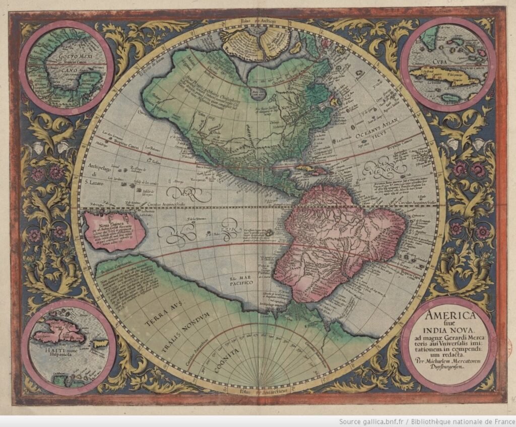
Like with artwork, the cartographer plays a major role in how much a map is worth. Works from famous cartographers like Gerard Mercator will often have a higher demand than maps from anonymous nobodies.
Mercator became famous in the 1500s after inventing a new method for depicting the Earth in 3 dimensions. Up until this point, maps were all in 2D.
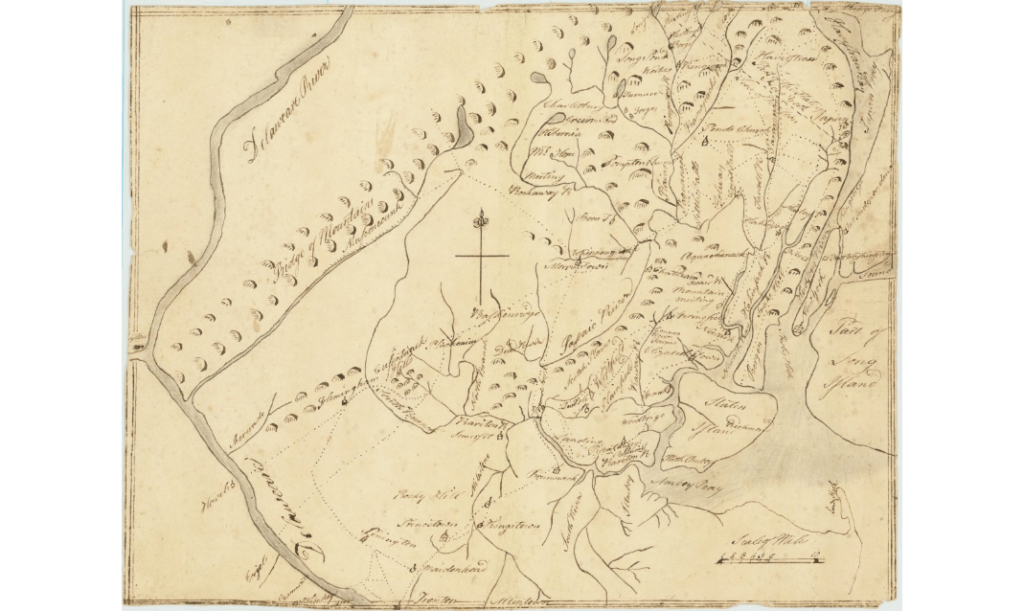
Anonymous maps are quite common, but can still draw major intrigue. This anonymous manuscript map (i.e., hand-drawn map) of New York and New Jersey from the late 1770s is valued at approximately $24,500.
The Era
As with most antiques, the rule of thumb is the same: The older the map, the rarer and more valuable it becomes.
For a long time, investors had little interest in maps made after 1950. However, as map collecting became more popular, this has become less true. Lately, there’s been a renewed desire for recent maps — even those from the 20th century.
There are two reasons why: nostalgia and technology.
Nostalgia is a recurring theme in the rise of alternative assets, and is a huge demand driver. People that grew up in the late 90s are now at that age where they can longingly look back on maps from their childhood.
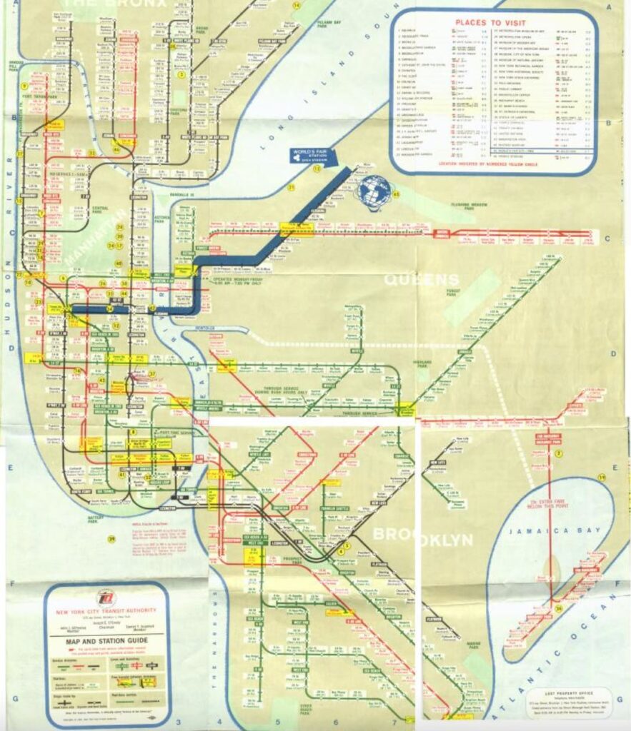
For example, old New York Subway maps have become a highly-sought-after map for collectors & hipsters alike. These intricate renditions of the sprawling train lines have gone from worthless to $1,000 each.
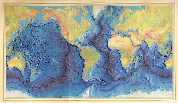
A great example of this is the ocean floor mapping by scientist Marie Tharp in the 1950s.
Back then, women were scientists were rare, and people were insane. They thought bringing a female on the boat would cause bad luck. Tharp literally wasn’t allowed to go on a voyage until the late 1960s!
Her work was critical. This was one of the first times a cartographer ever mapped the seafloor, and she helped scientists refine the theory of plate tectonics.
The Location
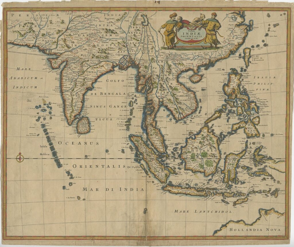
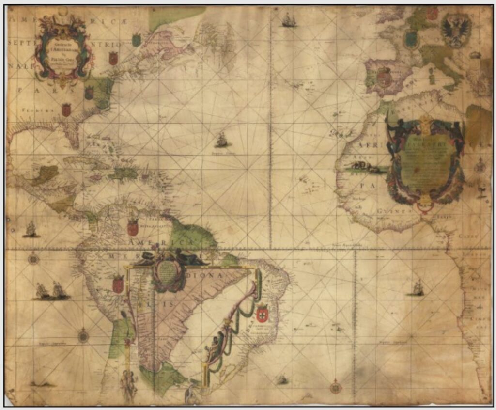
The most commonly traded maps are from Western cartographers, particularly Dutch, French, English, and Latin.
For many years, map traders collectively ignored Eastern areas, and the majority of items sold at auction or by dealers were focused on Western regions. But since eBay’s explosion in the early 2000s, the need for new and rare maps became important.
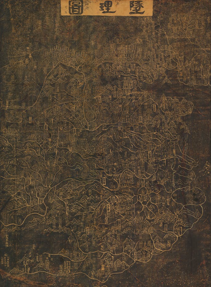
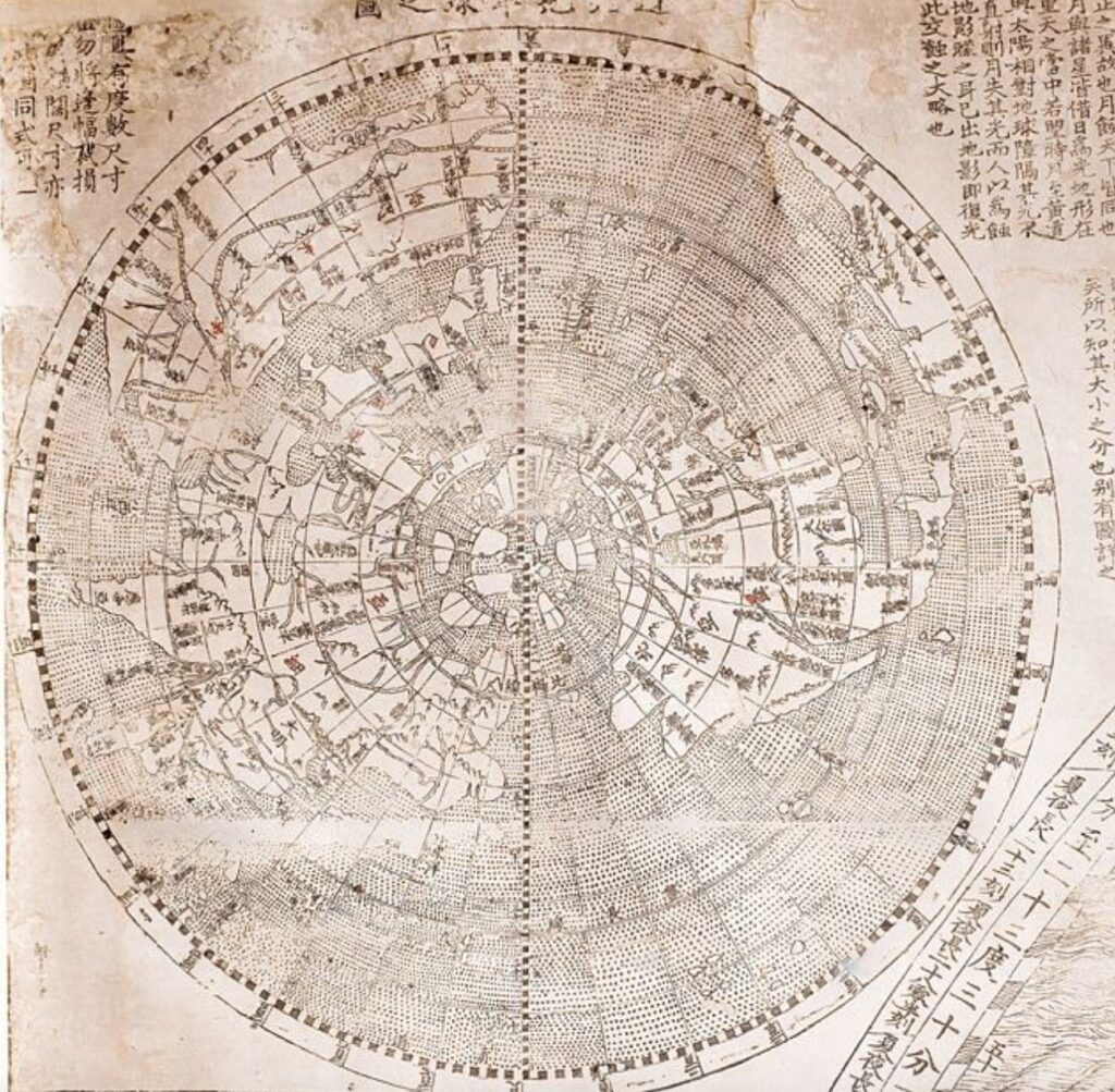
Nowadays, map dealers love maps of eastern lands — especially Korean, Japanese and Chinese geography. In fact, the earliest map of China, known as the Dili Tu, is a stone-engraved map from the year 1247. It’s typically listed by map dealers for around $350,000.
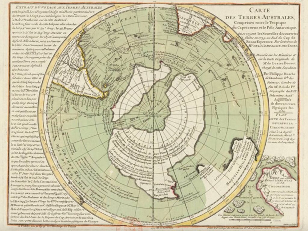
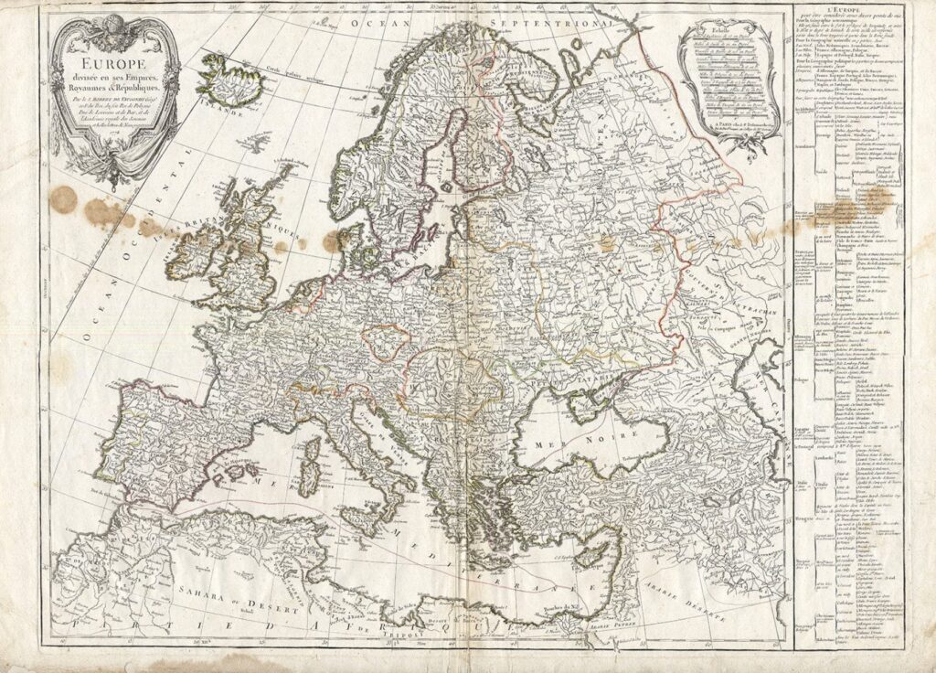
Geographic exclusivity also affects value. For example, a map of Antarctica will tend to fetch a higher price than, say, a generic map of Europe.
Scarcity
Like with most collectibles, scarcity is king. Hand-drawn maps are almost always rarer than prints.
The dream for any dealer is finding a map they’ve never seen before. If it’s a true one-of-one, the price can be well over $100k.
Condition
When talking about thousand-year-old maps, it’s basically impossible to find anything in mint condition. This is paper we’re talking about. Even if the map is well-protected, oxidization and general wear and tear inevitably take a massive toll.
When judging condition, there are a few issues to look for:
- Browning of the paper (you’ve probably noticed half the maps in this issue are brown. Not an accident)
- Foxing (a bit like the ‘liver spots’ older people get)
- Creasing
- Water stains
- Holes from parasites
Interestingly, maps from the 1600s are often in better condition than those from the 1800s. This is because of cotton. Cotton was easier to produce, so it became the main material for maps starting in the late 1800s. But compared to sturdy wood pulp, cotton was also thinner, cheaper, and more prone to ripping.
Color
Collectors tend to favor maps that are colored, as they typically allow more detail of geographical anomalies, are more exclusive, and are generally just better looking.
However, color wasn’t really added to maps until around the 1500s. Before this era, maps without color are actually more valuable. This is because most 1100–1500s colored maps being sold aren’t truly original – the color was added in after-the-fact.
Historical significance
Maps are like a time capsule of significant historical moments, and wartime maps are a particularly popular niche.
It’s fascinating to consider that maps are a product of their time and location. They aren’t “the truth”, but rather subjective depictions of history. In some senses, they are actually propaganda.
For example, many world maps crafted by French cartographers would make French territories bigger than they actually were or emphasize certain landmarks while ignoring others.
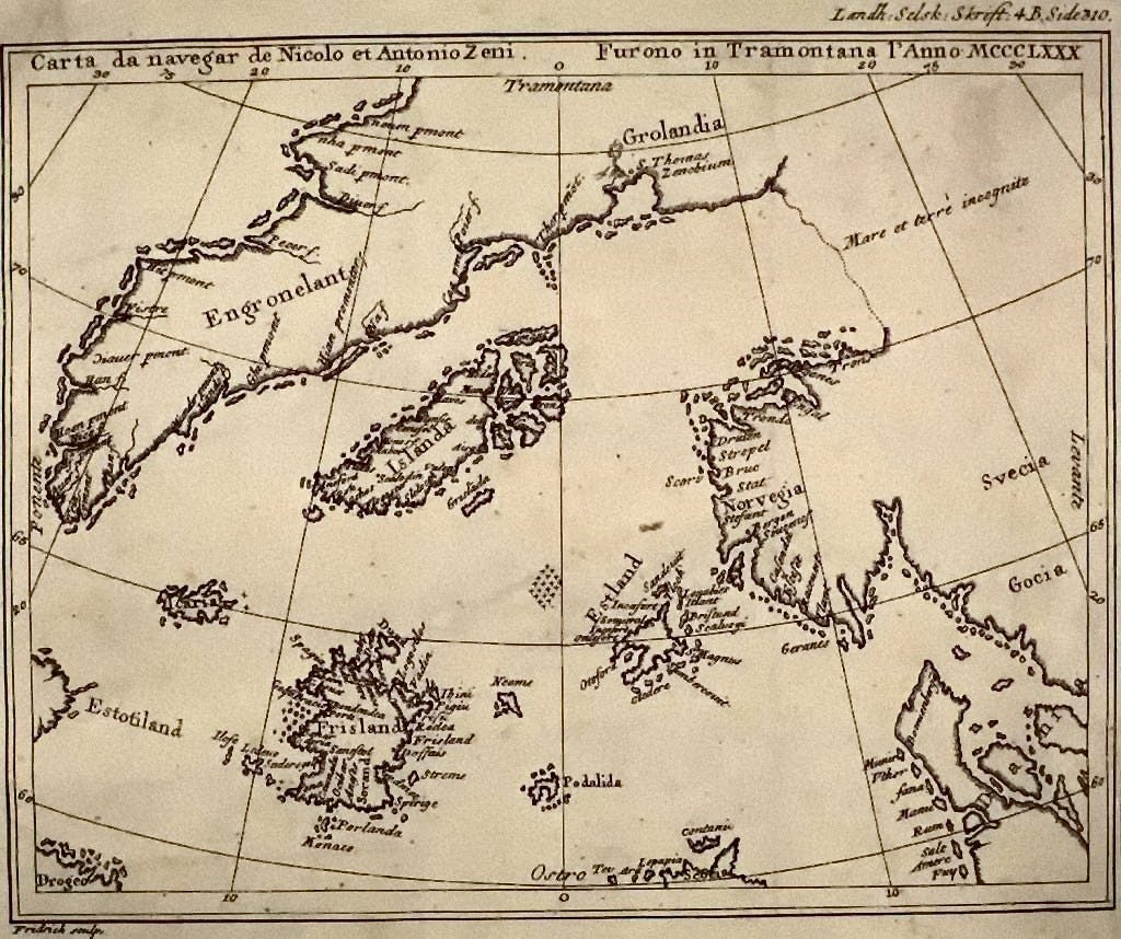
In the mid 1500s, Venetian explorer Niccolo Zeno tried to proclaim himself the discoverer of the New World instead of Columbus. Zeno included islands in his published works that didn’t actually exist. It took society hundreds of years to realize these lands were lies, yet many were included on world maps long after his death.
How much do antique maps cost?
Maps can be as expensive as mansions.
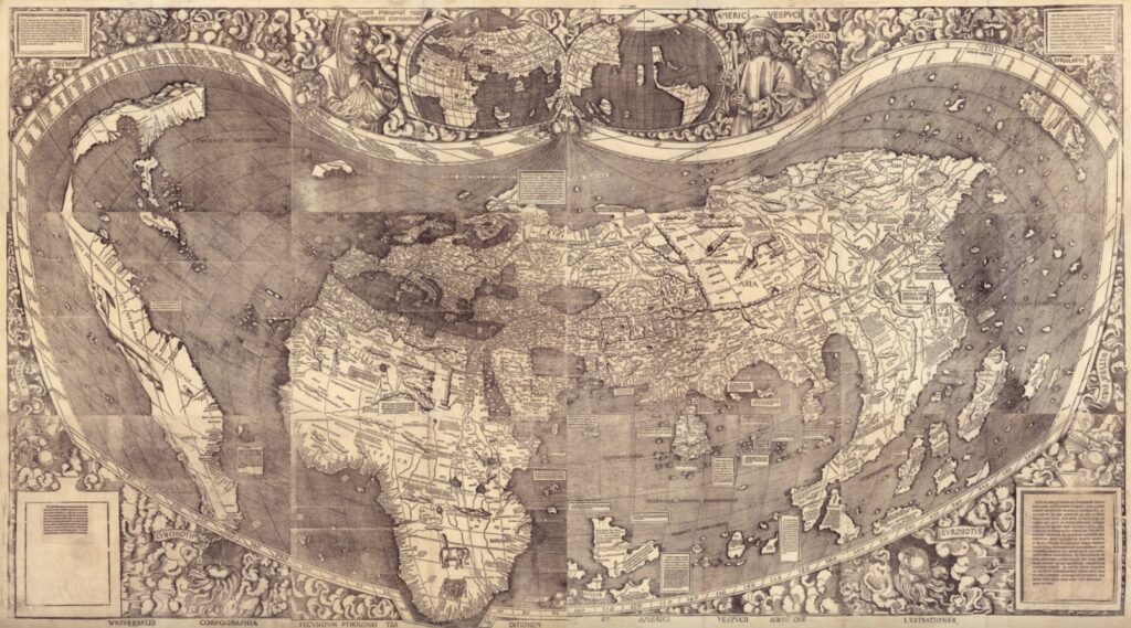
The most expensive one ever sold is a mouthful. It’s called… Universalis cosmographia secundum Ptholomaei traditionem et Americi Vespucci aliorumque Iustrationes.
It’s a 1507 world map from acclaimed German cartographer Martin Waldseemuller. At the time of its creation, 1,000 copies were released. But over the past 500 years, this has dwindled to just one – which was recovered in a German castle in 1901. Best of all, it was tightly bound and perfectly preserved.
The map is a behemoth. It comprises 12 sheets that, when put together, form a gigantic 8ft x 4ft 6inch piece.
This was the first world map to ever include America by name. In 2001, the United States Library of Congress purchased the map for a world record $10 million.
I’m an Aussie resident, and it’s always good to see our little (well, huge) island down-under represented in alternative asset markets.
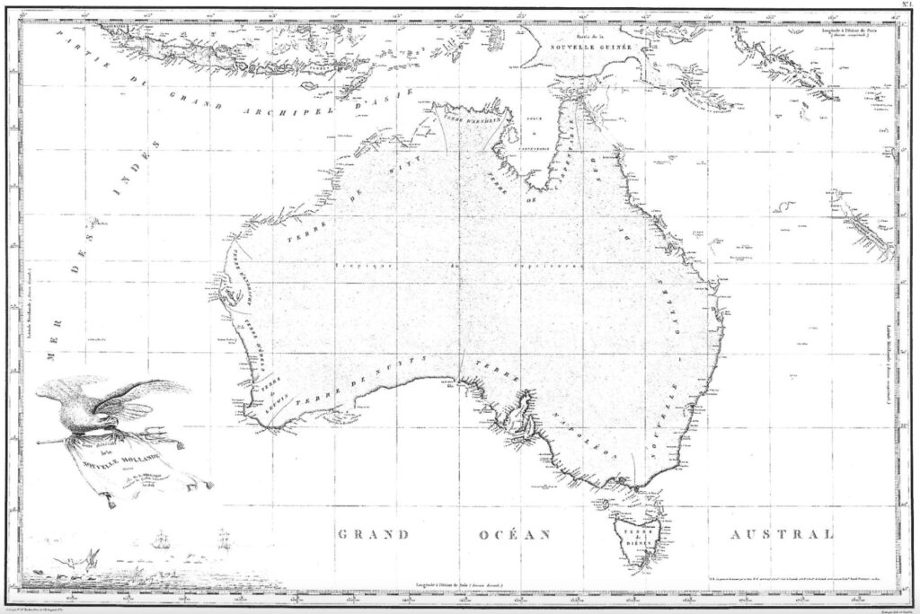
The first-ever map of Australia was drawn in 1811 (which, if you think about it, is really recent. America was on its 4th President by then!)
French cartographer Louise Freycinet took a trip with Nicolas Baudin to circumnavigate the continent. They discovered my town of Victor Harbor, and Baudin died of Tuberculosis on the trip home. Fun times.
It took the map a decade to be officially published, and a hundred years later, a copy was sold for $32,000.
One of the most valuable maps ever made was printed on an extremely unique material – rice paper. The 1602 world map was developed by French Cartographer Matteo Ricci at the behest of Chinese Emperor Wanli.
The map was the first Chinese edition to represent the Americas, portraying Ka-na-ta (Canada), Chih-Li (Chile) and Wa-ti-ma-la (Guatemala). Due to its rarity, Ricci’s creation was dubbed the ‘Impossible Black Tulip of Cartography.’
Only two of these maps still exist in any respectable condition. One of them was sold in 2010 to the James Ford Bell Trust for $1 million, making the Black Tulip one of only a few maps to become million-dollar babies.
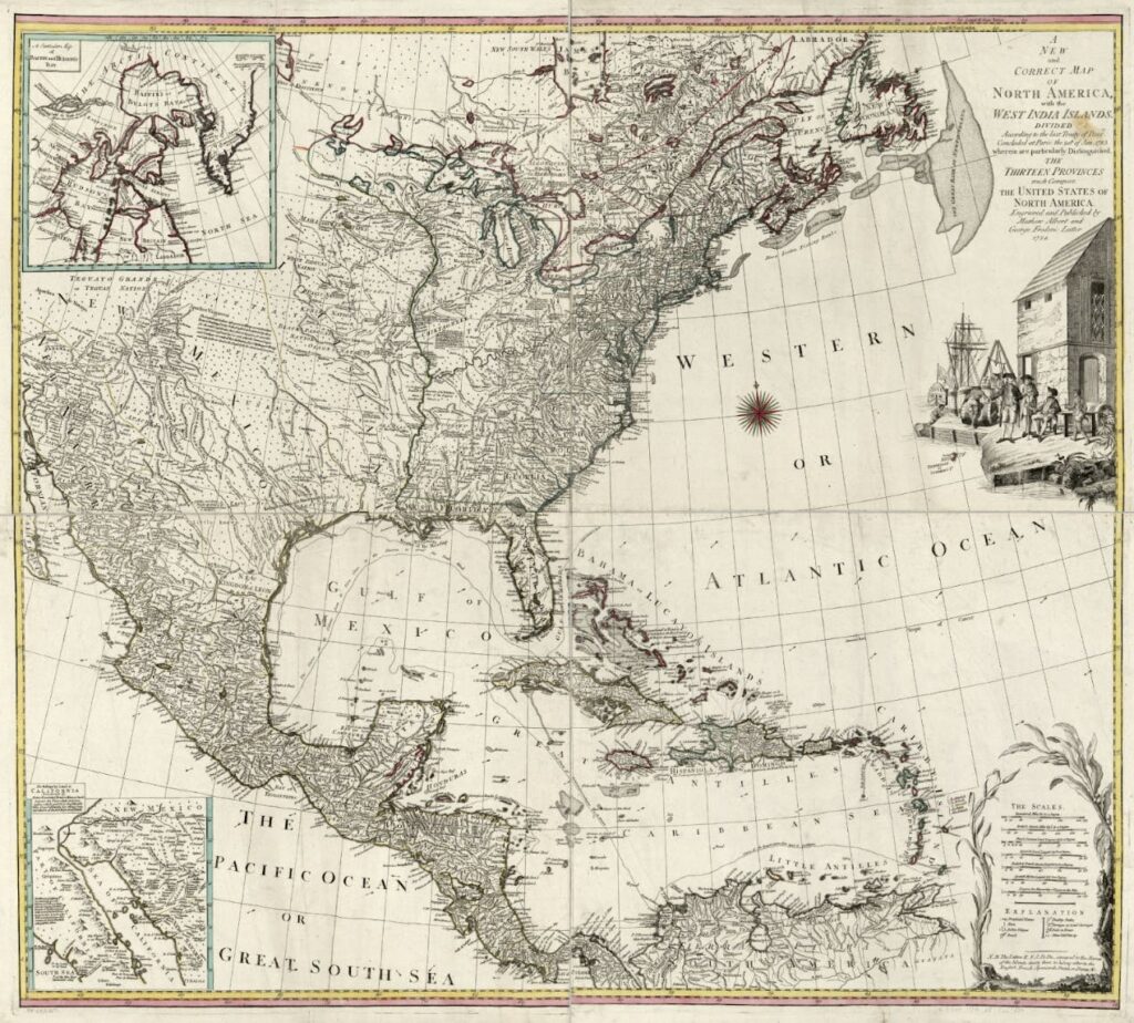
The most expensive map ever sold at auction was another depiction of America – the 1789 Abel Buell work named A New and Correct Map of the United States of North America.
Its prestige comes due to it being the first map printed of the US after independence from British rule. Only eight known reproductions exist. The map sold at a Christie’s auction in 2010 for $2.1 million.
What’s next for antique maps?
Maps are becoming a legitimate investment opportunity. So what’s next for this asset class?
Fractionalization is an obvious evolution here. Admittedly, many collectors want maps all to themselves, as they make a superb display piece.
With the ultra-rare & desirable maps going for hundreds of thousands of dollars, the growing map collecting community has demonstrated interest in sharing these gorgeous works with one another.
But while digital fractionalization is a somewhat new concept, “rings” of map dealers joining forces to purchase exclusive assets are not. In fact, map dealers have been forming syndicates for decades, sharing the glory (and profits) of beautiful maps.
There are no maps in the ALTS 1 Fund, but we would definitely consider acquiring one if the asset — and most importantly the price — is right.